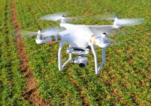
If precision technology has driven the farming revolution of recent years, monitoring crops from the sky will drive the next.
With using drone or UAV technology, you can capture highly accurate images of your fields, covering up to hundreds of hectares/acres in a single flight, without the cost and hassle of manned services. A  drone offers far greater resolution than satellite imagery provides, even when there is cloud cover.
Take for instance, Ryan Kunde, a winemaker whose picture-perfect vineyard is nestled north of San Francisco in the Sonoma Valley. He uses drone technology to better monitor his families’ vast vineyard.
He’s part of the vanguard of farmers who are using what was once military aviation technology to grow better grapes using pictures from the air, part of a broader trend of using sensors and robotics to bring big data to precision agriculture.
What drones means to farmers is simply that they now have a low-cost aerial camera platform by which they can better monitor their crops. They can use either miniature fixed-wing airplanes or, more commonly used, quadcopters and other multi-bladed small helicopters.
These aircraft are equipped with an autopilot using GPS and a standard camera controlled by the autopilot. Even though the camera may be a standard camera, having a clear ‘eye’ for your drone will give the best resolution with which to project your image into a high-resolution mosaic map. At UKA, our custom designed, precision lenses will further the iimages clarity. We are with your concept from design all the way through manufacturing of your specific lens.
With the drone having autopilot, it does all the flying, from takeoff to landing. The software can plan the flight path thereby aiming for maximum coverage of your fields and controls the camera to optimize the images for analysis.
Using drones for crop surveillance can drastically increase farm crop yields while minimizing the cost of walking the fields or airplane fly-over filming.
While not inclusive, some of the benefits of using drones in your farming industry could be finding potentially yield limiting problems in a timely fashion, thereby increasing yields. A farmer knows the value of scouting their crops, though few actually have the time to cover the acres by foot.
The return on the investment itself should be enough to convince farmers to embrace drone technology. At an average $2 per acre for visually inspecting the crops on foot or with aerial survey taking images of fields, the ROI on the purchase of an aerial helicopter drone can be met quickly. In most operations, the ROI for drones can be achieved in a crop season or less, leaving you owning a drone that reduces your operating costs and improves your crop yield by giving you the timely information you need for quick management intervention.
Farmers live and breathe on the health of their crops. Therefore, Crop Health Imaging – i.e., seeing the true health of their crops in a color contrast – will allow them to see how much sunlight is being absorbed by the crops canopy.
With technology that can pinpoint crops that need more attention, the farmer can address potential crop issues immediately, as opposed to after the fact. Mapping the crops is the key to boosting yields, cutting costs and driving their business forward.
Universe Kogaku designs and manufactures optical lenses for Agricultural drones, security, high tech and electronic applications. We stock 1000’s of standard lens assemblies and can custom design a solution for scanners, CCTV, CCD/CMOS, medical imaging, surveillance systems, machine vision and night vision systems.