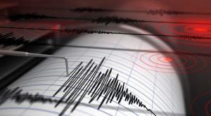
Can we really predict the next earthquake? No, not really, says Sam Howell – a doctoral candidate in geophysics at the University of Hawaii at Manoa – “It’s pretty much impossible to say when the next one will happen.”
A study focused on the region of the San Andreas Fault between Monterey County and Imperial County, hasn’t had any significant movement for over 150 years and other parts of the fault have been accumulating stress for more than 300 years. The San Andreas Fault runs for approximately 800 miles from the Pacific Coast, just south of Eureka, California to just north of Brawley, California.
For the first time, scientists have been able to ‘map’ out a computer image showing large sections of California rising and sinking around the San Andreas Fault. While some vertical movement makes a lot of sense, since California sits on the border of two gigantic tectonic plates — the Pacific and North American — that are constantly grinding past each other, eventually the result will be released in a large earthquake.
Though it’s been known for a while that parts of California rise, while other parts sink, actually observing it has been elusive goal, until now. “While the San Andreas GPS data has been publicly available for more than a decade, the vertical component of the measurements had largely been ignored in tectonic investigations because of difficulties in interpreting the noisy data. Using this technique, the (EarthScope Plate Boundary Observatory’s GPS’s system) we were able to break down the noisy signals to isolate a simple vertical motion pattern that curiously straddled the San Andreas Fault,” said Mr. Howell. Because of this technology, scientists are now able to record the data for the first time, giving them the ability to provide digital images to prove that these shifts, no matter how slight, are actually happening. With the large network of GPS-equipped monitors placed along the San Andreas Fault, scientists are now able to record movement of the land-mass on a continual basis. Equipping the GPS systems with a precision lens designed to the specific need can bring even more clarity to the digital images.
In April of 1906, an earthquake struck San Francisco with a magnitude of 7.8 taking more than 3,000 lives and destroying 28,000 buildings. On October 17, 1989, the bay area was rocked again with an earthquake measuring 6.9. While this toppled buildings, roads, bridges and homes, the loss of life was far less as it was Game 3 of the World Series between the Oakland Athletics and the San Francisco Giants. Many people were at the game, and far more already at home to watch the game.
The hope is, with the ability to measure the small slippage that happens, they will be able to someday successfully predict when a large quake is ready to strike, potentially saving thousands of lives.
The GPS systems and other monitoring devices are all equipped with specialized lenses to capture in minute detail every movement that occurs. Universe Kogaku designs and manufactures optical lenses for GPS systems, security, high tech and electronic applications. We stock 1000’s of standard lens assemblies and can custom design a solution for scanners, CCTV, CCD/CMOS, medical imaging, surveillance systems, machine vision and night vision systems.